

Introduction
This is Five Cents: travel guide to Tenerife. This guide helps you shape a week on an island best understood through contrasts, not by collecting beaches or chasing only the summit of Mount Teide.
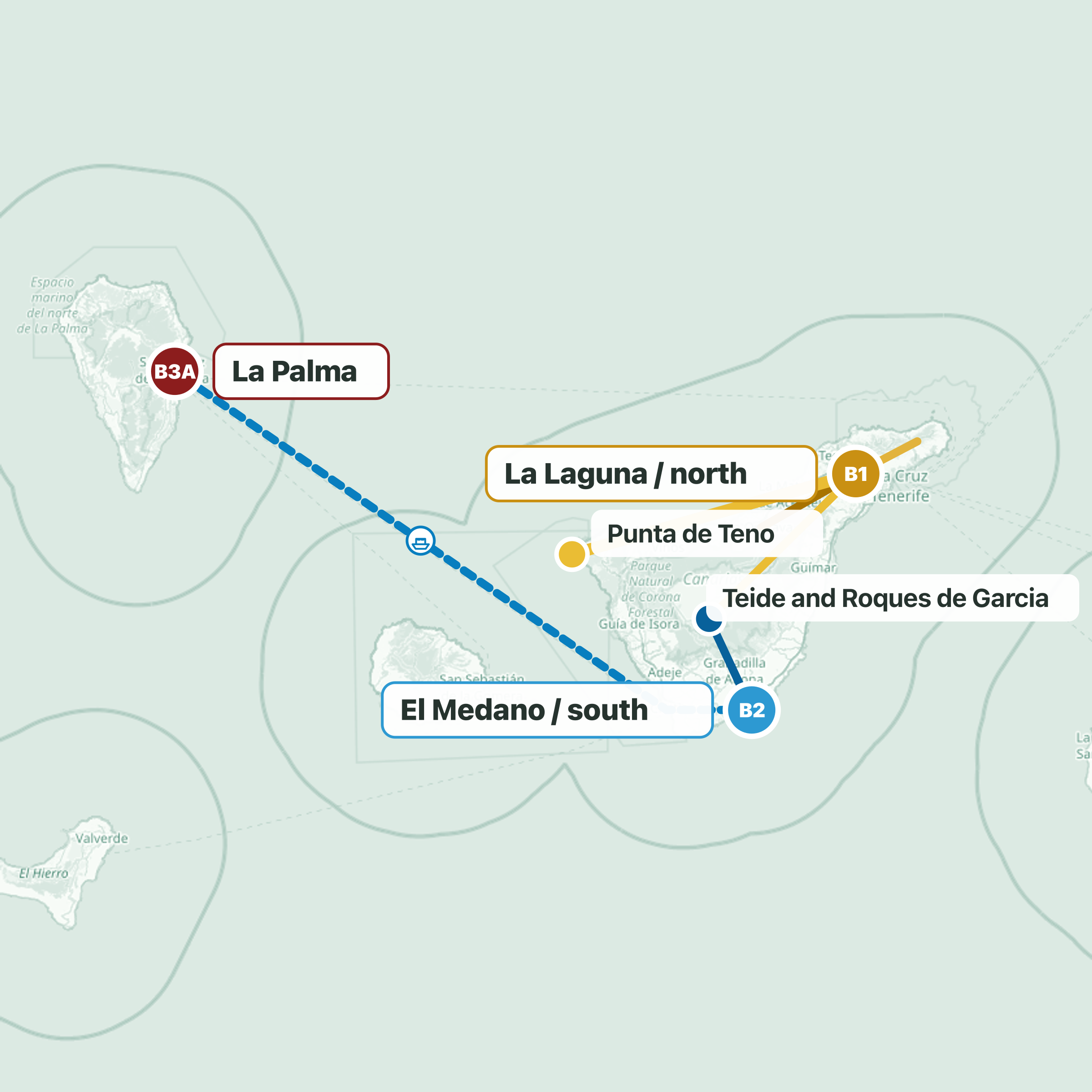
The route links the dry south
The route links the dry south, humid Anaga in the northeast, the historic north, the rugged west, and volcanic highlands. The decision that improves the trip most is splitting your stay between two bases. For six or seven days, hire a car and divide your time between the south and north. Tenerife is more mountainous than it looks on a map, and crossing it every day takes too much out of the journey.
Tenerife South Airport suits a southern first base; Tenerife North–Ciudad de La Laguna works if you begin in the north. From the south, you have the coast and a route up to Teide. From the north, Anaga, La Orotava, and the agricultural landscape are closer. Start by choosing the base that makes the rest of the island easier to read.
Begin in El Médano, a coastal town near the southern airport. It has a broad beach, promenade, square, and restaurants. Its character, though, comes from the wind: windsurfing and kitesurfing are part of everyday life here. It is the best base if you want a southern coast with a town-scale feel, distinct from Las Américas and Costa Adeje. Those areas concentrate hotels, entertainment, and services for travellers who prioritise convenience and sun, but they are far more built up.
From El Médano, La Tejita rounds out the southern stage. It is a wide beach beside Montaña Roja, with a more open, less urban feel than the larger resort complexes. Here, the wind-shaped landscape matters as much as the swimming. Then move north and drive towards the northeast. The transfer makes sense because the island changes with it: dry ground gives way to mountain roads, clouds held on the ridges, and dense vegetation.
Anaga Rural Park is a massif of ridges
Anaga Rural Park is a massif of ridges, ravines, and humid woodland. It offers one of Tenerife’s sharpest contrasts. The laurel forest, an ancient woodland fed by moisture from the clouds, explains the intense green. Stop at Pico del Inglés viewpoint to take in the layers of vegetation, hills, and ravines before descending towards the coast. The road goes down through Taganana, a historic settlement tucked among the mountains, to Roque de las Bodegas, a pause by the sea.
The landscape destination is Benijo: dark sand, large sea stacks offshore, and the feeling of reaching the end of the road. That descent, from forest to sea, captures Anaga better than a string of viewpoints. With a northern base around Puerto de la Cruz or La Orotava, make time for another side of the island.
La Orotava is a historic town above its valley, with steep streets, wooden balconies, and views towards Teide and the coast. It shows how traditional architecture relates to cultivated slopes. Food belongs in the same stage. Look for a guachinche, a family-run establishment originally connected with selling its own wine and simple Canarian dishes.
More than an isolated meal stop, it helps you understand the north as a landscape of vineyards, mid-altitude farmland, and local production. The next section heads west, where the terrain becomes more dramatic. Choose Punta de Teno as your one major western stop. It is the island’s northwestern tip, with a lighthouse, volcanic coast, and views towards the cliffs of the Teno massif. It is worth the trip for the sense of reaching Tenerife’s edge and for the open scale of the shoreline.
Access may be regulated
Access may be regulated, so confirm the current system when planning that day. Set aside another full day for Teide National Park, Tenerife’s geographical centre. Spain’s highest volcano and peak rises within Las Cañadas, a vast high-mountain volcanic depression. Drive up on one side and down on another to see the green north turn into the dry south. The main experience is Las Cañadas itself: lava flows, cones, mineral plains, and a scale that makes a rush for the summit unnecessary.
Add the walk around Roques de García. These are eroded rock formations facing Teide, and Roque Cinchado is among the most recognisable. It is the best way to get close to the park’s geology on foot without turning the day into a full mountain expedition. The cable car is an extra level: it reaches La Rambleta, not the summit. The Telesforo Bravo trail to the peak is a separate experience.
The park is already well understood through Las Cañadas and Roques de García. Keep three decisions in mind: use two bases if you have the time, give Teide a full day even without reaching the summit, and leave real time for Anaga and La Orotava. For your next Five Cents episode, you could explore La Palma after Tenerife, a multi-day extension through forests, banana plantations, and quieter coasts. Or create Tenerife for Surf, Wind and Beaches by Ability.